Thursday, July 12, 2018

North to Alaska: Copper River to Anchorage

We decided to go off the highway onto the road which leads into the Wrangell-St. Elias Wilderness and see what we could see.  We ended up in Chitina, which is a sweet LITTLE town on the way to the end of the road in McCarthy. The McCarthy road seemed a little too much for Maxine so we shopped at a delightful art gallery, Spirit Mountain, bought nothing but had a grand time looking and hearing the owner's stories.


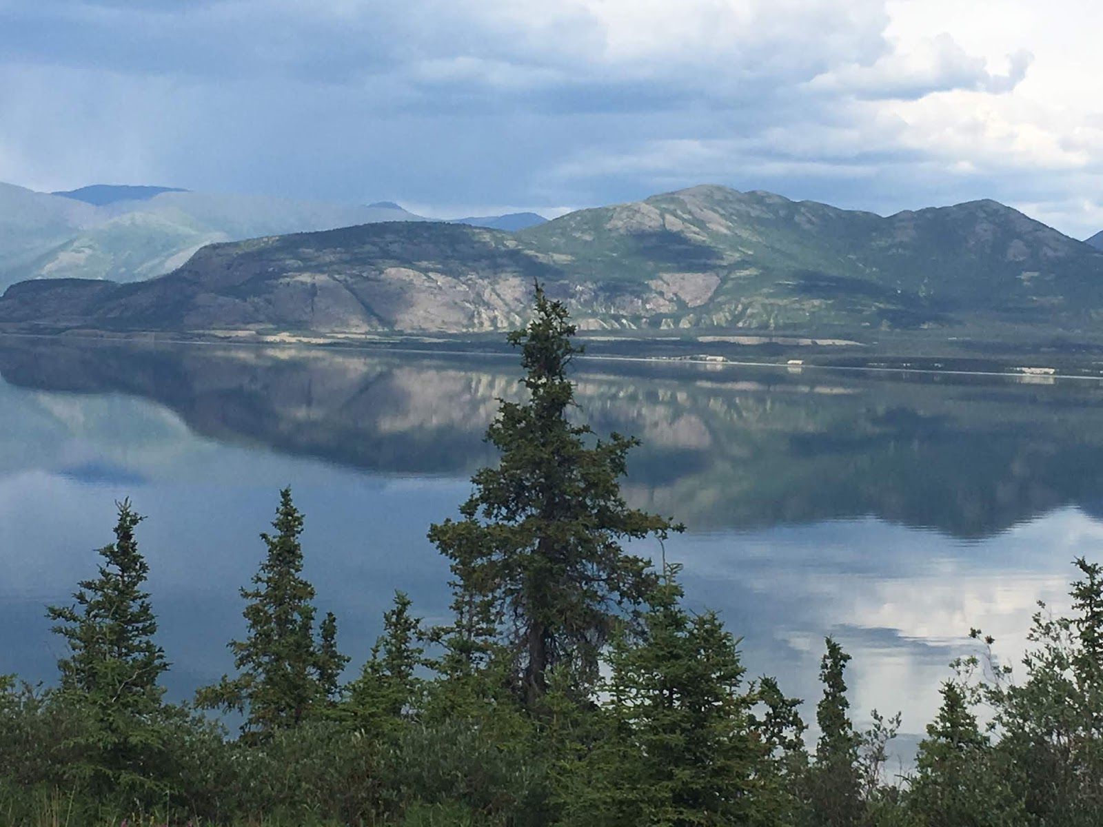
We decided to go down the road and camp along the Copper River, which is where the Chugach Mountains meet the confluence of the Gulf of Alaska and the Prince William Sound.  It is known for its incredible wild sockeye salmon, which is prized throughout the world.  Amazingly, it turns out that we were there on the opening day of the First Nations' Dipnetting event.

A more than impressive sight

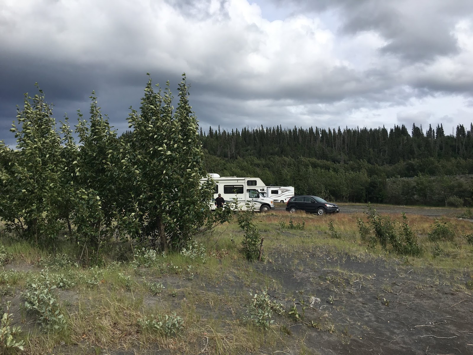
Our campsite
We are paying the Ahtna Tribe for our site along the river.  They are
the first peoples in North America to master working with metal.  They
are Athabaskan and are known for their arrowheads, bowls, spears, art and
copper bullets.

A short walk along the river

We awakened the first morning to the sound of a helicopter.  We later
found out that some fishermen were high centered on a gravel bar and one
of the fishermen drowned, trying to swim to shore.  The Coast Guard
rescued the other men.  The current is pretty darned strong here.

We were told that this area was completely flooded last year.

We wondered what all these cars were doing here on the side of the road.
Dipnetting began for locals at noon.  This is quite an event!  Native Alaskans
make this an interesting family event.  They all camp along the roads and
beaches where they have access to fishing.

This is the camping set up of one family.  Makeshift tents on the back of pickups
were the preferred camping method.  They all have cookstoves and
one even had a portapotty. 

Henry, our favorite of the native fishermen, explained the process and said
he would give us some of what he caught.  We couldn't stay long enough
to take him up on it.

All different kinds of nets are used.

This was one of the biggest nets!

This guy probably got here very early and is waiting until noon.

Lots of gravel bars where fishermen can wade out to and catch salmon in
the deeper parts of the river.  It doesn't look like it in this picture, but
the main part of the river is incredibly dangerous, as the current runs very fast.

This is an old fashioned fish wheel that was beside our campsite.  Some
still are used in some Alaskan rivers today.

The competition!!

Regretfully, we had to move on to get to Athena and Josh in Anchorage on time.  Poor babies have had a bunch of guests all summer.  We are going to try to get away on the week days and be with them on the weekends.  We were so incredibly thrilled with the beauty and wildness of the Glenn Highway into Anchorage-so many glaciers and lakes-just gorgeous!


We camped at King Mountain along the Matanuska River-swift current, milky white from glacier powder.  We sat along the river the first night, just drinking in the power and beauty of it.  We hiked a trail along the river, read, took showers and cooked gumbo.

King Mountain

The river from our campsite-too scary to sit there.


Like quicksand
 We stopped at the Musk Ox Farm on the way.  They are cute but this wasn't a highlight of the trip!  And their products are darned expensive!


THE HIGHLIGHT OF THE TRIP!!!!
WHAT A WELCOME SIGHT!


Wednesday, July 11, 2018

North to Alaska: Tok to Valdez


Tok is a gateway to all of Alaska-you have to come through it coming and going.  It was a major construction camp for the Alcan Highway in 1942 and now is a large service center with many gas stations, eateries and supply centers.  We gassed up, passed up the famous "Fast Eddies" for some terrific Thai food from a food truck and headed on down the road towards Valdez.  Very soon the highway winds through some beautiful views of the Wrangell Mountains.  


We took the Tok Cut Off down to Valdez, stopping at the Wrangell-St. Elias National Park and Preserve Visitor Center.  This was a beautifully arranged center, with outside exhibits, a movie theater, outdoor exhibits, a nature trail and interesting information about the area.  This is the largest national park in the country and it has 9 of the 16 highest mountains in North America!  It is not easily accessible by road.  We went down to Valdez first and then stopped in Chitina on our way back out.

This is a fishwheel.  They are widely used along the Yukon and Copper Rivers
for catching salmon.


An example of a Cache, where certain household items
equipment and food stuffs are stored.
A trail through the woods with views into the park

The view into the park from the Visitor Center


I know I keep exclaiming about the scenery and every road seems to have us wondering which of all these fabulous highways has the best views.  The trip down to Valdez was rainy and cloudy but that didn't stop the Richardson Highway from blowing our minds.  This road was constructed during the stampede of 1898 and has been used as a footpath, a telegraph right of way, a wagon trail and now a highway for cars.  It winds its way through several small towns and then climbs up the Edgerton Highway junction and follows the pipeline to Valdez.  We saw it a few times-smaller than we thought.  Below are some highlights of the mountains, waterfalls and glaciers we passed going over Thompson Pass, reminiscent of Trail Ridge Road in Rocky Mountain National Park.


Bridal Veil Falls

I love the glacier dust color of the water.

Worthington Glacier


When we arrived in Valdez (pronounced Valdeez), our planned-for campground was no longer and all that was available were downtown private RV parks, usually a nightmare to us, but today we were glad just to have a place close to town and the marinas to park Maxine.  We loved this town, but couldn't take advantage of most of the sweet outdoor restaurants because of the weather.  The town is reminiscent of a swiss ski area, except it is on the ocean.  We walked to local restaurants for wonderful halibut fish and chips and local cod.  We used our time to walk around the marina when the rain stopped, do our laundry and catch up on reading.  We would have stayed longer but the forecast was for more and more rain.

We had the place to ourselves for the first two days.


The ferry terminal


Lousy picture, but there were trumpeter swans along the road


Exit Glacier

Close up of the Glacier


Saturday, July 7, 2018

North to Alaska: Kluane National Park and Tetlin National Wildlife Refuge

We were stopped at the BC border for a search by a very nice young lady who checked our rig and car and proclaimed we could go on.  Whew!

Even though we had been on this highway before, we were still mesmerized by the views of glaciers and the incredibly gorgeous, fast moving rivers.  We headed towards Kluane National Park in the Yukon and couldn't get over the beauty here either.  Wondering if you lived here, would you just take the beauty for granted?  We just can't get over it.  We drove the road around Kluane Lake, never seeing another soul and very little in the way of a house or shack of any kind.  We learned that 300 or 400 years ago, the lake completely changed its course when a glacier closed its drainage outlet, raising the lake 30 feet and causing it to run south to the Gulf of Alaska and northeast to the Yukon River.

It was as smooth as glass when we arrived.  The fireweed just enhanced the beauty of the area.

Look at that water!  And how about the colors in the hills!?


We ended up at an absolutely fabulous place called Cottonwood RV Park.  The front area, looked just like a normal RV park and it was pretty crowded-apparently with caravans of people that travel together with similar RVs.  The owner said that if we didn't mind dry camping he had an area he thought we might like.  It was Nirvana-we might never have left if a huge wind and rain storm didn't move in and keep us inside.  And, we still had the problem with the toilet and the bathrooms were a good 1/4 mile down the road.


Can you beat this for a view!!?! We made some tequila cocktails and sat out for about an hour before the storm moved in.

Check out our nearest neighbors, sitting way down the beach!

The storm has begun!
Maxine is back in the trees, thank goodness.  So, the winds didn't keep
us from a good night's sleep!  The weather is still ok here.

The storm rolled in and we grabbed everything before it ended
up on the opposite shore!
 The next day we headed toward the Alaska border on the Alcan.  You hear so much about the Alaska Highway, but really, it is not in the best of shape (as is true, as we get closer to the border, of other main highways up here).  It suffers from frost heaves, pot holes and inconsistency.  You never know what the next section of the highway will be like.

This is what alot of it looks like.

We traveled through the Kluane Wildlife Sanctuary, where we saw a grizzly cross right in front of us.


The Tanana valley is one of the largest IBAs in the US.  This Important Birding Area is of global importance as it is essential for the breeding, wintering and migration of lots of species and in particular, of trumpeter swans and sandhill cranes.  We saw both species while we were here.
They call this area the Taiga, or Land of Little Sticks.  It is like a
boreal forest, very spongy, with small, skinny, dark black spruce trees.
 We didn't like the name but wanted a quiet spot and decided to stay at Deadman's Campground which is a US Fish and Wildlife area.  It is in the Tetlin National Wildlife Refuge.  It was wonderful.  There was alot of privacy at our campsite; they had a good clean bathroom (now, quite important); a gorgeous lake; campfire programs; and a lovely boardwalk nature trail.  Remarkably, they also had canoes and life vests for campers to use.  The only noise besides the sounds of birds is the occasional landing of a seaplane.


Dreaming of fishing
 The nature trail was very interesting to us.  This taiga forest is especiallly vulnerable to warming climate.  Global warming dries these wetlands, encourages invasive plants to grow here and creates larger and hotter fires which melt the permafrost and create insect infestations.  Its spongy, mossy soil insulates the frozen ground.  Apparently, if you don't have permafrost the soils are not drained well enough.  Alot of interesting plants:


Labrador Tea


Cotton plant

You can see why they call it "Land of Little Sticks".

Beautiful lily pads in the lake
 This area is a haven for wildlife.  Semi nomadic Athabascans settled here.  There are so many creeks and lakes, and rivers that it attracts the first of migrating birds.  The extended sunlight stimulates plant growth.  This land feels rich in many ways.

Sunset (about midnight?)

Jim got up early and drove down the road to a place
where he could get a fishing license.  He had a
great time paddling and fishing in this beautiful lake.


From our campsite
I went to a talk about beading from an Athabaskan woman.  She does beading and then puts them (moccasins, hair clips, patches, etc.) in her "treasure box" to give at potlatch.  Some of them are on plastic backing that she buys at a store and others are on moose hide that her aunt tans.  Her tribe only has a potlatch for a family who has lost a loved one.  A family from the opposite clan holds a potlatch  for the family of the deceased to thank them for helping with the arrangements for the deceased.  Her family lives on subsistence farming.  She says this year has been difficult as the King Salmon, which they like best has been pretty fished out (some kind of problem with spawning).

We had a big fire after the talk, cocktails and then a nice salmon dinner.  We were in bed by midnight.  Our bodily rhythms seem to be adjusting to the light.  In Mexico we are in bed by 9, whereas here, we are in bed some time about midnight.

We left on the Alcan again.  Heading for Tok and down the Cut off to the Richardson Highway to Valdez.