Arriving in Anchorage by plane was spectacular! You can spot glaciers everywhere and the mountaintops just pop right out of the clouds.
We spent a couple of nights with Athena and Josh but thought it best to get back on the road as soon as possible and leave them to their own devices! It was hard to leave them but the road beckoned.
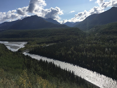
We drove through Glacier Country from Palmer to Eureka. Mat-Su is short for the Matanuska and Susitna Rivers which form the region. Again, the weather in Anchorage was just beautiful-sunny and in the 60s. We stopped a lot to gaze at the mountains, lakes and rivers along the way and camped in the Tolsana Wilderness at a campground along the river. There were more people than we had hoped for, but it was Labor Day weekend, after all.
 |
| The glacial toe |
We were amazed at our little private space by the creek, as the campground was filled. It was warm enough for an outdoor dinner and we spent the evening, as we usually did, mapping the plan for the following day. This night we needed to decide if we wanted to hurry home the fast way or have another adventure. We opted for another adventure! (of course)
We headed up north on the Glenn Highway to the Richardson to Tok Cut-Off to the Taylor Highway. The Cut-Off was much worse than we remembered but we were going the other direction this time. There was continuous paved/gravel/paved areas, frost heaves that made your stomach turn upside down when you didn't see them coming and lots and lots of pot holes.
 |
| Incredible mountains at every turn in the road |
 |
| A fabulous area for Trumpeter Swans |
 |
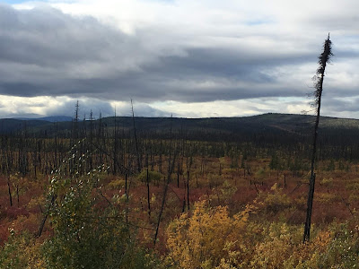
Going up the Taylor-everything changed! Suddenly the glaciers and
mountains were in the far distance and the boreal forest was everywhere,
with characteristic black spruce twigs, an occasional northern hawk owl and
even a peregrine falcon. The vistas were huge and fall had definitely arrived
in the north country. There was no one on the highway, thankfully (but that
has been the case almost everywhere!) |
 |
| We drove right into a cloud! |
 |
| The colors blew us away! |
 |
The road was iffy but, because there were no other cars,
it was a breeze. This might give you the idea that it
was mainly paved-not so! |
 |
| It was reassuring to see how much new growth has appeared since a 2004 fire |
We camped on top of a mesa, overlooking a lake, on the West Fork of the Fortymile River. This whole area is known as the "Fortymile". Like so many places we have experienced this summer, you could spend the whole summer exploring this area. The Fortymile was gold country at the turn of the century. Back then, it was not accessible as it is today. Travelers walked overland with packhorses or poled up the river and in winter, by dog sled. Prospectors gave the Fortymile River its name because it enters the Yukon River about 40 miles below the former Hudson's Bay post of Fort Reliance. If I was younger, what fun it would be to run this river!
 |
| Looking pretty calm here |
We just had to see the little town of Chicken! And little it was! The town used to be known as Ptarmigan but early miners could not spell that and settled instead for Chicken, the common name in the north for ptarmigan. There is no city water, sewer or electricity here. Both of us read the book, Tisha, which is about a teacher who came to Chicken from California and learned alot about life in the north country of Alaska at the beginning of the 20th century. What I loved about the book was her inability to tolerate prejudice towards natives and, in fact, she adopted two native children.
We loved the local saloon which had all manner of memorabilia hanging from the ceiling, from panties and bras to hats, to flags, t-shirts and who knew what else. We wished it wasn't morning, as we might have partaken of a local beer and warmed up by the wood stove.
 |
| My favorite building, the Chicken Poop |
 |
| Downtown Chicken |
From Chicken, we took the Top of the World Highway to Dawson City. The road was very high, very beautiful and a little sketchy-I drove, so I wouldn't make Jim crazy whining and weeping the whole time. Therefore, I did not get very many pictures. It was a narrow, winding road with steep grades and few guardrails. Sometimes, there were no shoulders. Thankfully, there was very little traffic.
 |
| Boo loved it, especially when offered a bit of beef jerky. |
"A land shaped by the power of running water. A river whose valleys cradle caribou, and echo the cries of peregrine falcons. A land of seasonal abundance to the first who lived here - the native
Athabascans. A source of hidden gold that beckoned strong spirited souls. A region that still calls the adventurous to discover her history, wildlife and free-flowing waters."


No comments:
Post a Comment